C-ALS® borehole deployable laser scanner for concealed cavity and void scanning
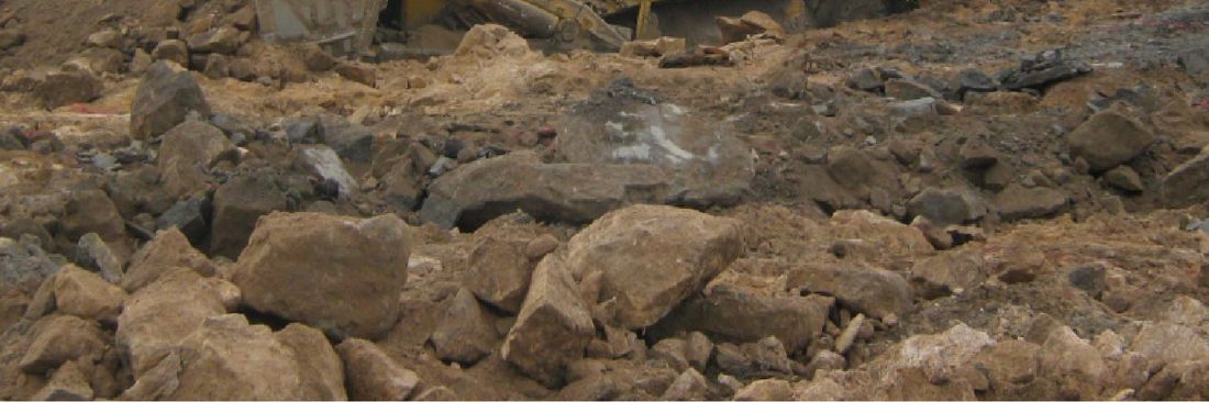
The C-ALS can be used in a huge range of applications, wherever an inaccessible void exists and accurate data is required to monitor excavations, assess risk or design solutions. Once deployed, the C-ALS gives more detailed, accurate data than alternative technologies, such as ground penetrating-radar, and is the only borehole-deployable laser solution on the market.
- Plan new projects: assess risk, design solutions based on accurate underground data, add C-ALS data to your existing maps and devise new programmes of work.
- Improve productivity: with accurate maps of voids, you can design plans, which allow for efficient mining or construction projects.
- Improve safety: map inaccessible underground areas to ensure operations keep employees safe.
Advantages of laser scanning with C-ALS:
The C-ALS system's unique 50 mm diameter allows deployment into cost-narrow boreholes, and the 360° spherical coverage gives you a full view from a single scan, without blind spots.
In addition, C-ALS offers the following benefits:
|
|
How it works:
With a diameter of just 50 mm, C-ALS is easily deployed through boreholes, downhole or uphole to survey inaccessible spaces.
A system of hinged, lightweight one-metre rods provide a fixed azimuth capability, as well as giving you the ability to deploy the C-ALS down boreholes as long as 200m. The C-ALS can also be deployed by boom or by remote-controlled vehicle.
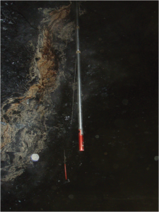
A nosecone camera gives you full visibility of the borehole during deployment, so operators can see any obstructions, as well as judge the point when the C-ALS enters the void.
The C-ALS® probe incorporates pitch and roll sensors and has the option of an internal compass. The sensors ensure the C-ALS can be tracked down the borehole and that the scan is automatically geo-referenced to fit into existing 3D mine data.
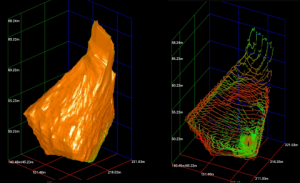
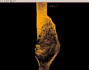
Once in the void, a simple click from the operator tells the laser-scanning head to rotate on two axes, measuring the three dimensional shape of the void, with full 360° coverage and no blind spots, and with a range up to 150m.
A load-bearing cable attached to the probe transmits all the measured data back to the surface unit and a ruggedised computer loaded with our Cavity Profiler software is used to control the C-ALS® from a safe location and to view the data in real-time.
The new user-friendly operating software makes it easier and quicker for operators to use the system, by guiding them through the process of deploying and scanning.
Applications where C-ALS provides data when personnel cannot enter:
|
|